
by Rachael N. Darmanin
The term ‘robot’ tends to conjure up images of well-known metal characters like C-3P0, R2-D2, and WALL-E. The robotics research boom has in the end enabled the introduction of real robots into our homes, workspaces, and recreational places. The pop culture icons we loved have now been replaced with the likes of robot vacuums such as the Roomba and home-automated systems for smoke detectors, or WIFI-enabled thermostats, such as the Nest. Nonetheless, building a fully autonomous mobile robot is still a momentous task. In order to purposefully travel around its environment, a mobile robot has to answer the questions ‘where am I?’, ‘where should I go next?’ and ‘how am I going to get there?’
Like humans, mobile robots must have some awareness of their surroundings in order to carry out tasks autonomously. A map comes in handy for humans. A robot could build the map itself while exploring an unknown environment—this is a process called Simultaneous Localisation and Mapping (SLAM). For the robot to decide which location to explore next, however, an exploration strategy would need to be devised, and the path planner would guide the robot to navigate to the next location, which increases the map’s size.

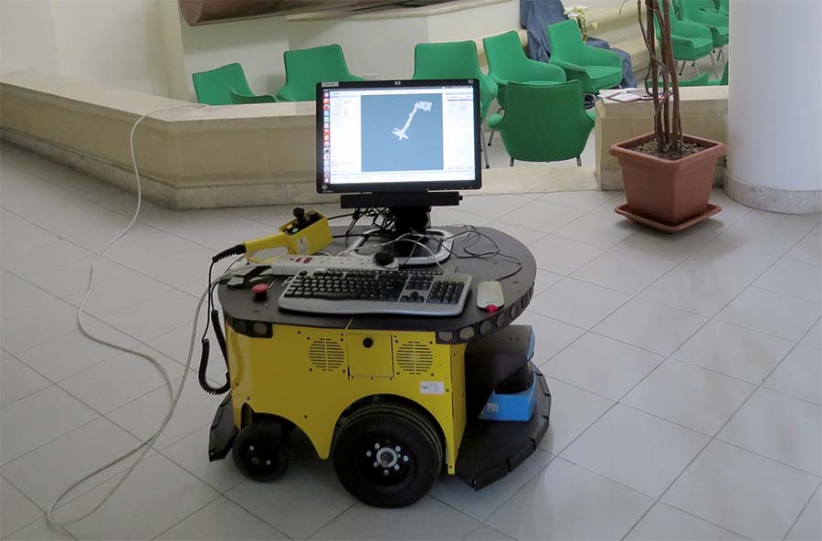
Rachael Darmanin (supervised by Dr Ing. Marvin Bugeja), used a software framework called Robot Operating System (ROS) to develop a robot system that can explore and map an unknown environment on its own. Darmanin used a differential-drive-wheeled mobile robot, dubbed PowerBot, equipped with a laser scanner (LIDAR) and wheel encoders. The algorithms responsible for localising the robot analyse the sensors’ data and construct the map. In her experiments, Darmanin implemented two different exploration strategies, the Nearest Frontier and the Next Best View, on the same system to map the Control Systems Engineering Laboratory. Each experiment ran for approximately two minutes until the robot finished its exploration and produced a map of its surroundings. This was then compared to a map of the environment to evaluate the robot’s mapping accuracy. The Next Best View approach generated the most accurate maps.
Mobile robots with autonomous exploration and mapping capabilities have massive relevance to society. They can aid hazardous exploration, like nuclear disasters, or access uncharted archaeological sites. They could also help in search and rescue operations where they would be used to navigate in disaster-stricken environments. For her doctorate, Darmanin is now looking into how multiple robots can work together to survey a large area—with a few other solutions in between.


Comments are closed for this article!