
Continuous measurement and analysis of marine conditions in real time is allowing local users to better understand the short and long-term implications of the changing sea. Prof. Aldo Drago writes.
Every good decision is an informed one. For that to be possible, data is essential.
When Malta was under British rule, the Armed Forces handled the gathering of marine data and its dissemination to ships and stakeholders through the British Hydrographic Office. They were responsible for safe entry and exit of large ships in our harbours. They aided in search and rescue missions. Then came Maltese independence. With that, the British left, and so did their expertise, leaving behind a devastating massive lacuna.
Since the early 90s, the Physical Oceanography Unit, now established as the Physical Oceanography Research Group (Department of Geosciences, Faculty of Science, University of Malta [UoM]), has endeavoured to fill this gap.
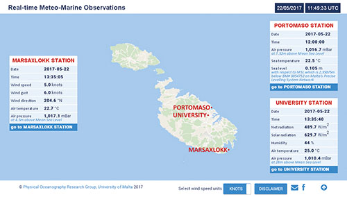
The first ever digital sea level station in Mellieħa Bay and the meteo station in Ramla Bay were set up in 1993 and 1994 respectively. Data was collected in delayed mode by storing it in high-capacity data loggers on site, accessing it for viewing and processing in retrospect every couple of weeks. Advances in telemetry subsequently made it possible to receive data directly from the system of sensors on a station to a dedicated University server by a dial-up bundled transfer of data packs. Such an installation was set up in 2001 at Portomaso, delivering sea level, sea temperature, and atmospheric pressure with updates every hour—slow by today’s standards.
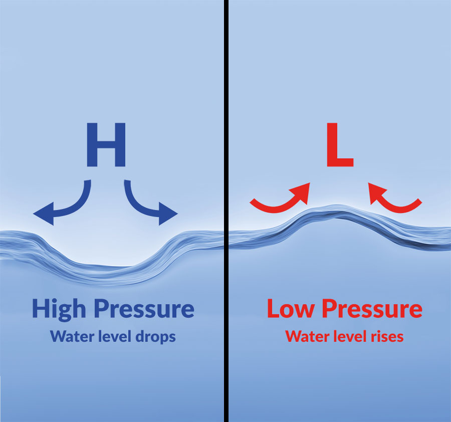
The 2010 upgrade now allows the station to deliver fast data streams to the control and processing centre at the UoM, where it is automatically quality controlled while publishing, within moments, over dedicated web servers. Sea level updates are received every 15 seconds and shared within the MedGLOSS regional monitoring network, contributing to the first phase of a Mediterranean tsunami early detection system. The system also monitors for seiching events (a standing wave) that can be hazardous to movement of ships and their berthing in harbours. The accumulation of long-term sea level data sets are then useful to determine trends and indicators of climatic changes, and essential to determine the impact of saltwater intrusions in aquifers.
Today, the number of monitoring stations has increased. The tip of the breakwater at the sea entrance of Marsaxlokk harbour boasts one. The University campus is home to another. They both serve to provide early warnings of adverse atmospheric conditions, especially for port operations and the safer navigation of ships into and out of the port.
This information is delivered in real time and free of charge as an online service on a dedicated web interface. User-friendly displays and plainly presented data makes this useful to both professional and casual users.
Current plans are to continue adding more of these stations working around the clock. In collaboration with Transport Malta, other stations in the Grand Harbour, Ċirkewwa, Mġarr, and possibly southern Sicily will join the network, providing an extended service and targeting more users.


Comments are closed for this article!