Discarded Seismic Signals Monitor Groundwater
Malta depends on subterranean groundwater for agriculture, industry, and a large population. A University of Malta initiative, Project SIGMA, is monitoring groundwater sources not by digging for them, but by listening. Jonathan Firbank speaks with the Project SIGMA team about this novel approach and the impact it could have on our future.
Fresh water is the first and last concern of any country. Settlements spring up at river mouths and lakesides. Food grows where there is steady rain or easy irrigation. Conversely, drought can destroy nations, and the struggle against it drives scientific development. If no fresh water is found above ground, it must be found below. The search for this precious resource is so desperate that, to this day, diviners wielding dowsing rods can find employment, despite the practice having long been proven useless.
Of all European countries, Malta has the most challenging relationship with water, ‘facing the highest stress on its water resources,’ explains Dr Matthew Agius (Research Support Officer, Department of Geosciences). Malta is known for its semi-arid climate and little rainfall. Agius goes on to explain how ‘Malta also has no major surface water bodies such as rivers or lakes. Furthermore, Malta has a very high population density,’ compounded by its tourism, which hit a record high before the global pandemic in 2020. This places incredible pressure on Malta’s two sources of freshwater: desalination and groundwater.
The less vital of the two is desalination, which is the removal of salt from seawater. This is costly both from a financial and an environmental standpoint, as resources such as oil or gas are required to power the desalination process. More crucial is groundwater. This is rainwater that has pooled below ground in porous rock formations known as ‘aquifers’. In Malta, this precious resource is extracted from boreholes or underground galleries. Groundwater supports Maltese industry and contributes 80% of the water needed for agriculture. ‘Sustainable management of groundwater resources in Malta is essential,’ explains Prof. Sebastiano D’Amico (Head of the Department of Geosciences and the project’s principal investigator). This has already motivated initiatives such as supporting irrigation by treating and recycling greywater (the excess water produced by our kitchens and bathrooms).
D’Amico goes on to explain how ‘conventionally, groundwater in Malta is monitored using a network of boreholes managed by the Water Services Corporation and the Energy and Water Agency (EWA). Water level data is recorded from these boreholes, and these measurements provide the most accurate site-specific data on water levels. However, this conventional practice may not provide insight into the changing groundwater levels in the remaining regions.’ The dynamism of Malta’s remaining groundwater demands a dynamic means of finding it.
Mapping Changes in Seismic Velocity
SIGMA stands for Seismic Imaging of Groundwater for Maltese Aquifers, a University of Malta project funded by the EWA. The space occupied by groundwater cannot be seen or physically explored without invasive techniques such as drilling. It can, however, be ‘heard’. Different materials reflect, absorb, and transmit seismic waves (vibrations generated by an earthquake, explosion, or similar energetic source which travels through the earth) to different degrees. The presence (or absence) of water in porous rocks alters these properties. In particular, water-saturated rocks have increased pore pressure, which in turn, leads to the opening of cracks in the rock that reduces the contact area between different grains of rock. This leads to a decrease in seismic velocity. SIGMA analyses these seismic properties in order to determine the state of the aquifer.
Something does have to generate the seismic waves in the first place, though. Fortunately, Malta has no shortage of ambient seismic noise, from the vibrations produced by sea waves hitting the coast to the noise produced by its roads. As these vibrations pass through Malta’s crust, they are recorded on seismographs of the Malta Seismic Network and can be analysed to map Malta’s sub surface and, crucially, its groundwater. The question is how to read it.
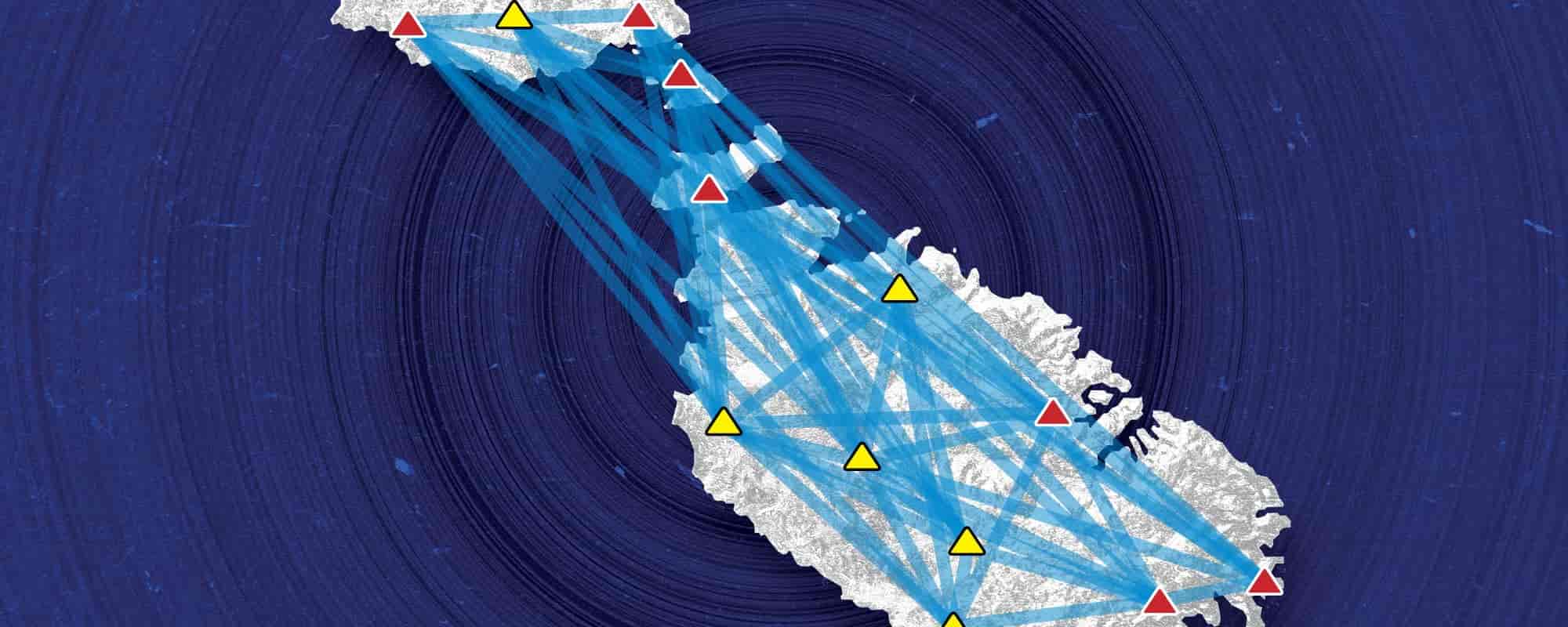
SIGMA began with conversations between international colleagues who specialise in interpreting this data. Prof. Pauline Galea, coordinator of the Seismic Monitoring and Research Group and co-principal investigator on SIGMA tells how the team ‘was proposing an EU-funded project that would look at ambient noise monitoring of groundwater at different scales, in different geographical settings. Until funds are procured for this project, Research and Innovation grants from the Energy and Water Agency gave us an excellent opportunity to carry out a proof-of-concept of the technique within the Maltese islands, an idea which was totally new to the country.’ The Malta Seismic Network already records a large amount of seismic data on stations across the country. Each station utilises GPS timing, data acquisition, and data transmission systems to process information collected from seismometers. These seismometers ‘are generally sensitive enough to record microns of ground displacement. For example, vibrations from a large earthquake in the Pacific Ocean would be easily recorded on a seismometer in Malta,’ explains Galea. SIGMA also makes use of six temporary stations deployed between 2017-2018, supplementing the Malta Seismic Network’s stations and providing better coverage across the islands. This creates a comprehensive net for the sensing of Malta’s noise.
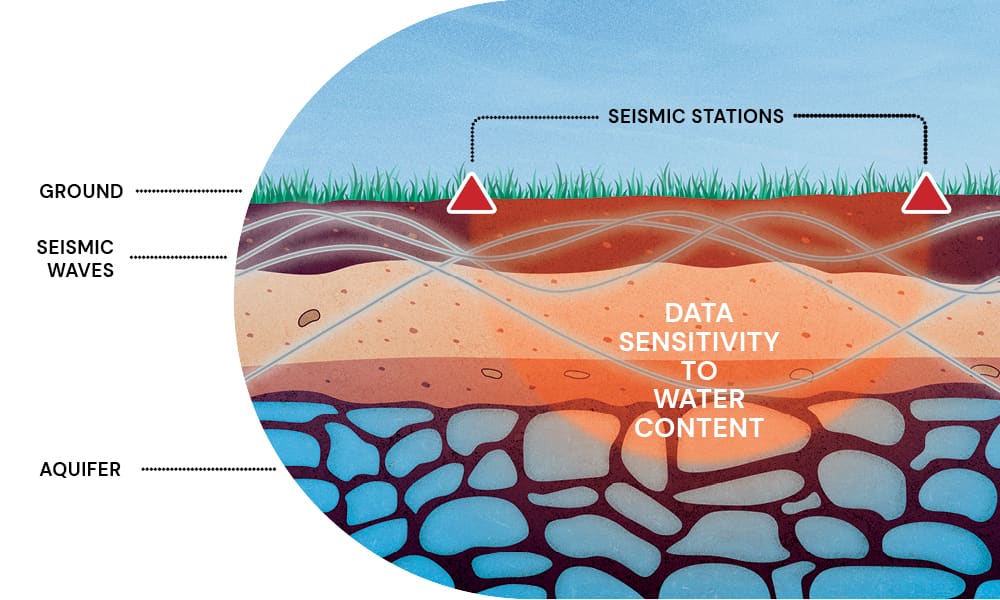
Agius explains how ‘the team used signal processing techniques that correlate signals recorded on the different stations’ to detect groundwater changes by listening to ‘seismic noise made up of continuous vibrations of the ground surface and shallow rock layers’. These vibrations can be equally useful whether they come from the natural world or the bustle of Malta’s population. ‘This method gives us the opportunity to assess the groundwater over a greater area and may provide a broader picture of the subsurface groundwater,’ says Agius. Master’s student Luca Laudi has seen results detecting seasonal and annual changes in seismic wave speeds that may be correlated with the levels of Malta’s groundwater. ‘This is important since most studies that have been conducted abroad have been from large groundwater basins, complex aquifer systems, volcanoes, mountain regions, geothermal fields, groundwater exploitation fields, larger islands, and volcanic islands.’ Malta is subtler than these spaces; ‘it has relatively smaller aquifer systems, it is surrounded by saltwater at close distances, and it has no rivers, lakes, or mountain regions. Despite this, the results of the study show that this signal processing technique can be used to monitor Malta’s groundwater levels.’ Unlike systems based on boreholes, SIGMA’s methods are non-invasive. Additionally, apart from its novelty, this approach utilises resources that already exist.
Mapping the Future
This approach has clear utility. Should its findings be more definitely corroborated by readings from Malta’s boreholes, SIGMA’s next task is to determine whether the approach can be adopted in a more permanent and continuous manner. If Malta turns to ‘listening’ for water instead of digging for it, more seismic stations would be invaluable. This would ‘provide a more accurate representation of the changing groundwater levels. Additionally, collecting more seismic data in the future may help in understanding whether this technique can identify long-term trends in the groundwater levels i.e. over decades,’ says D’Amico. More data enables more targeted experiments. These could include work to better determine the specific volume of groundwater in a space. They could also correlate data with Malta’s limited rainfall to better understand rainwater’s lifecycle in the aquifers below the surface.
Malta’s need to optimise freshwater access is great, but it is in no way unique. The climate is becoming harsher, surface water is being mismanaged, and population growth puts an exponential strain on its availability. Groundwater, often contaminated or overexploited, is in extremely high demand. Malta’s dependency on it makes this a natural place for innovation, but project SIGMA’s methods are just as applicable elsewhere. Agius goes on to say how ‘groundwater level decline is an ongoing global concern. Utilising different subsurface imaging techniques for sustainable groundwater resource management is becoming essential. These systems are easy to install and cost-effective to maintain in the long run, making it an ideal tool to provide understanding of groundwater bodies. For these reasons, these techniques should be investigated further, to continuously manage groundwater as an essential resource for future generations.’
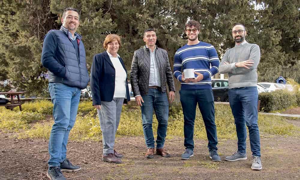
Project SIGMA is financed by the Energy and Water Agency under the National Strategy for Research and Innovation in Energy and Water (2021-2030). Principal investigators of SIGMA are Prof. Sebastiano D’Amico and Prof. Pauline Galea, Dr Matthew Agius and Dr Emanuele Colica are Research Support Officers on the project, and Mr Luca Laudi has submitted his Master’s thesis entitled ‘A novel approach to groundwater monitoring in the Maltese Islands: Analysis of auto- and cross-correlation functions of ambient seismic noise’


Comments are closed for this article!