
Meet the mobile app that’s making the sea safer for sailors and citizens alike.
 Ahead of departing on voyages at sea, mariners, fishermen, and leisure craft owners need to plan and make journeys that are as safe and efficient as possible. This means they are always in search of the latest and most accurate data on weather and marine conditions. But how to obtain this information?
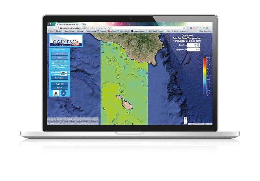
Well, now there’s an app for that! Seafarers navigating around or close to the Maltese islands and southern Sicily now have an onboard digital assistant called KAPTAN, Maltese for ‘Captain’. The app brings key data to personal smartphones, using real-time marine and weather prediction services to provide high-resolution local data. With just a few clicks, users have interactive spatial maps at their fingertips, giving them details on prevailing conditions at sea, as well as short term past and forecast information.
| Did you know? |
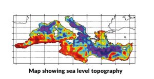 The ocean, like the atmosphere, is a fundamentally turbulent system. Its motion is characterised by meandering streams and many small-scale circulations in the form of mesoscale eddies. These are dynamic, rotating structures of water that are continuously evolving in time and space, influencing the ‘weather’ of the sea. Although only the surface expression of mesoscale eddies is visible in satellite images of the sea surface (observing height or temperature), they are in fact 3D structures that reach down into the pycnocline where water density increases rapidly with depth. In the Mediterranean, the sizes of these eddies are around 10 to 20 kilometres, or four times smaller than in the oceans, and much smaller than the atmospheric high and low pressure systems normally seen on weather maps. The ocean, like the atmosphere, is a fundamentally turbulent system. Its motion is characterised by meandering streams and many small-scale circulations in the form of mesoscale eddies. These are dynamic, rotating structures of water that are continuously evolving in time and space, influencing the ‘weather’ of the sea. Although only the surface expression of mesoscale eddies is visible in satellite images of the sea surface (observing height or temperature), they are in fact 3D structures that reach down into the pycnocline where water density increases rapidly with depth. In the Mediterranean, the sizes of these eddies are around 10 to 20 kilometres, or four times smaller than in the oceans, and much smaller than the atmospheric high and low pressure systems normally seen on weather maps. |
KAPTAN was developed within the CALYPSO project, an Italia-Malta cross-border cooperation initiative led by the Physical Oceanography Research Group (Department of Geosciences, Faculty of Science, University of Malta [UoM]). The face of the app was designed by THINK, a local digital agency and web design company. The service integrates observations from the CALYPSO HF radar network, which consists of four CODAR SeaSonde installations on the northern Maltese and southern Sicilian shores. Satellite observations are added to high resolution weather and marine numerical models run by the UoM team specifically for the Malta-Sicily Channel. This yields a full suite of very local meteo-marine reporting and complements other weather forecasts and local weather stations. What makes KAPTAN different is that the app provides maps and point data showing the dynamic structures of the atmosphere, variability in sea surface currents, temperature, and waves, and shows how all of these evolve in space and with time. The user can get the specific data they need when they need it.
KAPTAN looks set to make a splash. The app’s data is useful for many at sea. This is the key added value of KAPTAN: making data easily and freely available not only to researchers, public authorities, and environmental agencies, but also to other citizens. KAPTAN is a service that will make travel at sea safer and more comfortable.


Comments are closed for this article!